Welcome Guest ( Log In | Register ) The Gallery Links Link Exchange Boat ramps

  |

 Sep 11 2010, 02:59 PM Sep 11 2010, 02:59 PM
Post
#1
|
|
 *FruitLoop* 53  Group: Donator Posts: 2,043 Joined: 13-April 07 From: Out in the sticks Member No.: 3 |
Does anyone know if there is a GPS overlay map of the marine parks that can be downloaded to gps units?
The Game council does this for hunting exclusion zones by just making them dark gray on a map.. You would think that MPA or someone would have similar for Marine Parks? |
 |
 
|


|
Sep 12 2010, 12:54 AM
Post
#2
|
|
 His Eminance Group: Administrators Posts: 5,725 Joined: 13-April 07 From: Sydney Member No.: 2 |
Prob not spud
I did notice that last trip I did down to Batemans Bay that when I picked up the local map of the zones Pretty sure gps co-ords were given where the buoys were droped outlining the zones --------------------  Save The Fish, Eat a Pussy |
|
|
|

|
Sep 12 2010, 05:09 AM
Post
#3
|
|
 *Narcho's* Group: Members Posts: 294 Joined: 22-February 08 From: Batemans Bay Member No.: 2,557 |
i wrote to the mpa and asked for the same thing. Eventualy they sent me a overlay for google earth. Now if you have a smart phone you may be able to do something with that. The copy I have is for the batemans marine park. I could send it to you
Sent you a copy via email This post has been edited by Sir Reel: Sep 12 2010, 05:11 AM -------------------- insanity takes it's toll, I make sure I have plenty of spare change
Catch ya L8ter John 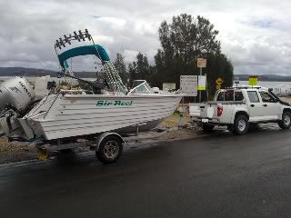 |
|
|
|
|
Sep 12 2010, 01:24 PM
Post
#4
|
|
 *Mr Shiny Head* Group: Members Posts: 2,221 Joined: 14-April 07 Member No.: 7 |
Check this out, stumbled across it on the net.
http://www.exploroz.com/Shop/GPS/GlobalSat..._Mouse_GPS.aspx How good is that for $80? A lot of info on that site but it all goes over my head. I just found a USB port on my TV that takes a memory stick to watch slides or play movies, cool. I use my GPS as a speedo. HaHaHaHa! --------------------  SEAFARER: Fine as a Fairy's Fart |
|
|
|

|
Sep 12 2010, 01:50 PM
Post
#5
|
|
|
*FruitLoop* 53 Group: Donator Posts: 2,043 Joined: 13-April 07 From: Out in the sticks Member No.: 3 |
Thanks Sir Reel.... Ill check it out tonight...
its a shame mapsource wont receive info from google earth.. It will transfer from mapsource to google earth which is great for seeing where you have been but you cant plot a course.. Wonder if any of the paid for maps have marine parks in them? |
|
|
|
|
Sep 12 2010, 02:25 PM
Post
#6
|
|
|
*FruitLoop* 53 Group: Donator Posts: 2,043 Joined: 13-April 07 From: Out in the sticks Member No.: 3 |
that file you sent is a KML file Sir Reel...
If i can get my virtual box to recognise my usb/gps ill get a converter and convert the KML file to something mapsource can read and should be able to send it back to you in a format you can use.. Leave it with me.. |
|
|
|
|
Sep 12 2010, 05:07 PM
Post
#7
|
|
|
His Eminance Group: Administrators Posts: 5,725 Joined: 13-April 07 From: Sydney Member No.: 2 |
QUOTE (Fed @ Sep 13 2010, 07:24 AM)  Check this out, I use my GPS as a speedo. HaHaHaHa! So ewe wear it to hide your dooberlacky huh Fed , do ewe use the anchor rope to hold it in position ??  Really should make up your mind r u ALP [Peter Garrett original Mr Shinny Head] or Lib [Tony Abbot Mr Smuggler ] -------------------- Save The Fish, Eat a Pussy |
|
|
|
|
Sep 12 2010, 09:52 PM
Post
#8
|
|
|
*FruitLoop* 53 Group: Donator Posts: 2,043 Joined: 13-April 07 From: Out in the sticks Member No.: 3 |
FYI, Reply from MPA
QUOTE Hi Chad,
Thanks for your enquiry in regards to the Marine Parkzoning on a GPS unit. Yes, there are plans to have zoning available via electronic means forupload to GPS units and other marine navigation equipment in the near future. Unfortunately it’s not yet available (we still need to sort out dataformats and an update procedure etc). In the mean time the zones for all of the Marine Parks are describedwith coordinates on the Marine Parks Authority NSW website at http://www.mpa.nsw.gov.au/regulation/index.html You can enter points into your GPS that form the boundaries of zones. Sorry it’s still a manual process at this stage but we’reworking at making it better. Cheers, Brent |
|
|
|
|
Sep 13 2010, 11:45 PM
Post
#9
|
|
|
*Narcho's* Group: Members Posts: 294 Joined: 22-February 08 From: Batemans Bay Member No.: 2,557 |
hi Chad
If you have google earth loaded on your computer double click the KML file and google earth will open loading the Marine Park I also have a kml file of nsw state forests / national parks as well, might be handy for your hunting / camping etc. Just recently I sent my Navionics card away for updating, it has all Marine parks preloaded. Is your unit a Medallion®Viper as they also have a card for that. They also have one for iphones etc simular price to what Fed said. http://www.navionics.com/SearchResults.asp...words=australia -------------------- insanity takes it's toll, I make sure I have plenty of spare change
Catch ya L8ter John |
|
|
|
|
Sep 14 2010, 09:00 PM
Post
#10
|
|
|
*FruitLoop* 53 Group: Donator Posts: 2,043 Joined: 13-April 07 From: Out in the sticks Member No.: 3 |
QUOTE (Sir Reel @ Sep 14 2010, 05:45 PM) hi Chad If you have google earth loaded on your computer double click the KML file and google earth will open loading the Marine Park I also have a kml file of nsw state forests / national parks as well, might be handy for your hunting / camping etc. Just recently I sent my Navionics card away for updating, it has all Marine parks preloaded. Is your unit a Medallion®Viper as they also have a card for that. They also have one for iphones etc simular price to what Fed said. http://www.navionics.com/SearchResults.asp...words=australia Got all the forest loaded into my GPS, My unit is a Garmin Astro.. I have all the forests etc, and the game council have a overlay that shows exclusion zones etc.. The KML file can be converted back to GPS format which once i get my ass into gear i will have a go.. The Astro, second pic shows think line where i walk, thin line is where dogs been.. can give each dog individual colour! 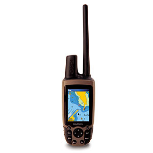  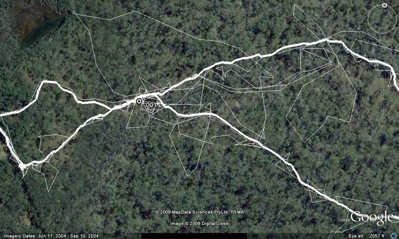
|
|
|
|
|
Sep 14 2010, 10:23 PM
Post
#11
|
|
|
His Eminance Group: Administrators Posts: 5,725 Joined: 13-April 07 From: Sydney Member No.: 2 |
Your dosen't count Spud
GPS stands for Global Positioning System not Giant Potato Sack
-------------------- Save The Fish, Eat a Pussy |
|
|
|
|
Sep 15 2010, 02:37 PM
Post
#12
|
|
|
*Mr Shiny Head* Group: Members Posts: 2,221 Joined: 14-April 07 Member No.: 7 |
Your dogs sure do stop for a lot of pees Rumpus.
-------------------- SEAFARER: Fine as a Fairy's Fart |
|
|
|
|
Sep 16 2010, 12:58 PM
Post
#13
|
|
 the wizz kid Group: Members Posts: 693 Joined: 14-April 07 From: manilla,kingstown Member No.: 9 |
nah fed there just waiting for the ole fulla to catch up,,,jas
-------------------- allways in the shit ,its just the depth that varies
|
|
|
|
|
2 User(s) are reading this topic (2 Guests and 0 Anonymous Users)
0 Members:
| Lo-Fi Version | Time is now: 5th February 2025 - 07:07 AM |